Garmin Oregon 750 GPS
Brand: Garmin
Reference: 010-01672-23
€561.35
Product sold out, not available at this time.
Next stock entry on the way, expected
Description
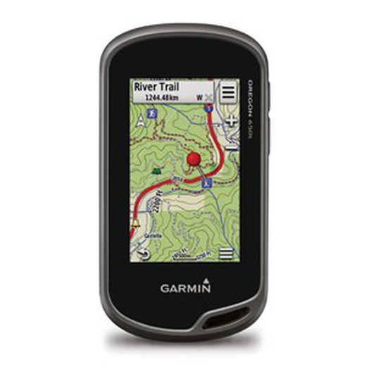
The 750 is at the top of the Oregon series, with new features that give a new boost of functionality and quality to the series.
Details
More information
The incorporation of the 8 mpx camera with integrated zoom just with the ANT + technology, is the greatest exponent of these novelties. This GPS will become essential in your mountain excursions or trips.
Bright, shock and water resistant 3 " touch screen . Enjoy the best visibility, even in adverse conditions.The triplet of the three-axis electronic compass , altimeter, and topographic basemaps built into the GPS is the best guarantee for good orientation. Control the slopes and do not lose detail of your scheduled route. The autonomy of more than 16h is more than enough to complete your route.
Camera with autofocus, zoom and LED flash, 8 megapixels, allows you to save and share every step you make or every landscape you want to immortalize.
Characteristics:
- Unit dimensions (Width / Height / Depth): 6.1 x 11.4 x 3.3 cm
- Screen size (Width / Height): 3.8 width x 6.3 cm height; 7.6 cm diagonal
- Screen resolution (Width / Height): 240 x 400 pixels
- Screen type: Transflective color TFT touch screen
- Touch screen: YES
- Weight: 209.8 g with batteries
- Battery: NiMH rechargeable battery (included) or 2 AA batteries (not included);
- Battery life: 16 hours
- Water resistance classification: IPX7
- High Sensitivity Receiver: Yes
- Computer interface: Compatible with high speed USB and NMEA 0183
- Camera: Yes (8 megapixels with autofocus;? Digital zoom and flash)
- Barometric altimeter: Yes
- Electronic compass: Yes (three axes with offset tilt)
- Unit-to-unit transfer (shares data wirelessly with similar units): Yes (with custom images and maps)
- Basemap: Yes
- Preloaded maps: Yes (topographic)
- Ability to add maps: Yes
- Internal memory: 4GB
- Accepts data cards: Yes, microSD ™ card (not included)
- Customizable POIs (possibility to add additional POIs): Yes
- Waypoints: 4000
- Routes: 200
- Track log: 10,000 points, 200 saved tracks
- Automatic route creation (turn by turn on the road): Yes (with optional maps with detailed road information)
- Geocaching mode: Yes (paperless)
- Compatible custom maps: Yes
- Hunting and Fishing Calendar: Yes
- Astronomical information: Yes
- Tide Prediction: Yes (with optional BlueChart)
- Area calculation: Yes
- Image viewer: Yes
- Garmin Connect ™: Compatible with Garmin Connect ™ (online community where you can analyze, classify and share data)
Comments
There are no opinions yet Be the first to review!
Questions
No questions yet Do you have any doubt?
Best price
Have you seen it cheaper?
